Residential Group Housing DWG – Site Layout with 2 & 3 BHK Towers
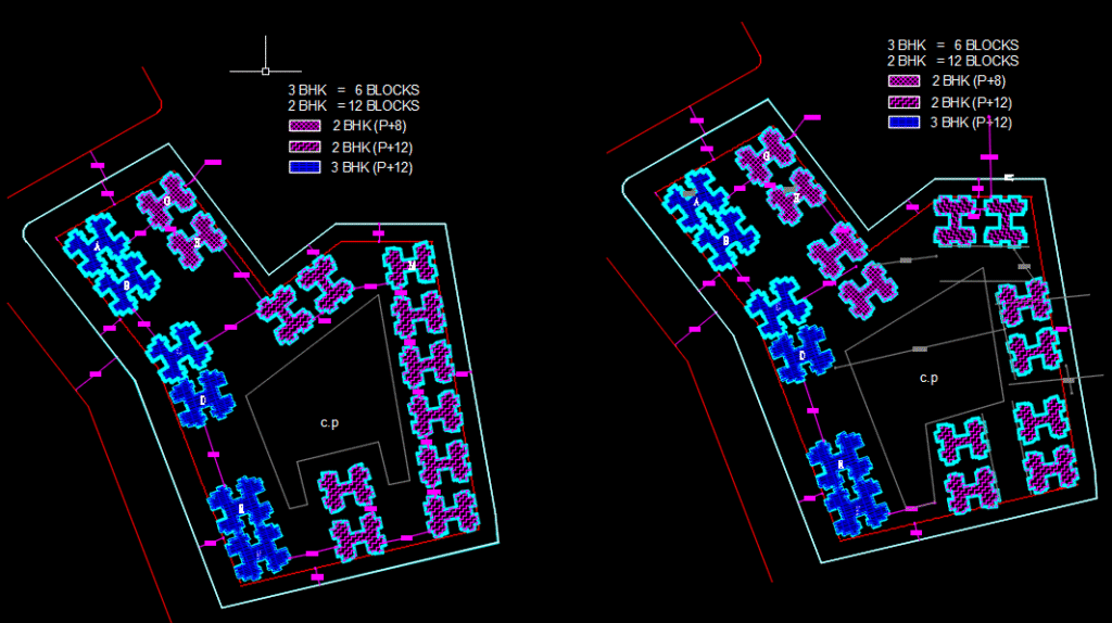
Download this full group housing layout DWG showing 18 residential towers, with 2BHK & 3BHK blocks (P+8 & P+12). Perfect for students, urban designers, and architects working on high-density housing projects. 🧱 1. What’s in This Layout Drawing? This plan features a G+12 (P+12) multi-storey residential complex arranged in a rectangular layout with: 🏢 2 […]
Landscape Architecture DWG Plan – Download Campus Layout with Full Legend + AutoCAD Tutorial
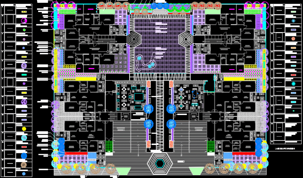
Download a detailed DWG drawing of a landscaped institutional complex with legends and rooms. Learn how to read and recreate integrated architecture-landscape designs in AutoCAD. 🏛️ 1. What This Drawing Includes This plan showcases a landscape-rich building layout, featuring: 🏠 Symmetrical built structures (room units in 4 wings) 🌳 Garden zones, water features, paved plazas […]
Free Delhi Urban Fabric DWG Map – Explore & Recreate Lutyens’ Delhi in AutoCAD
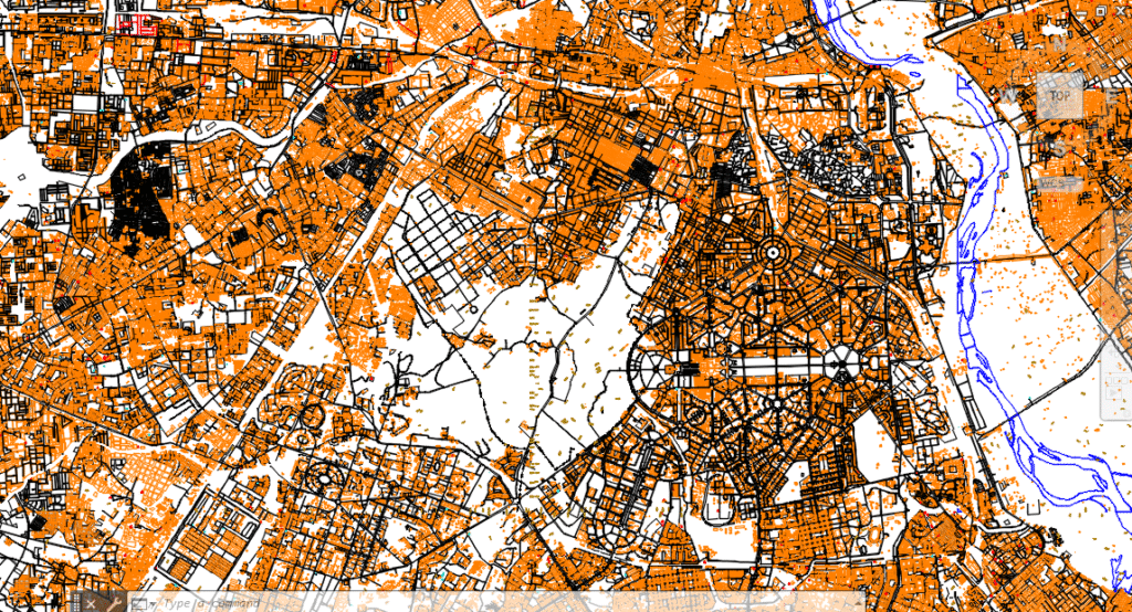
Explore Delhi’s most iconic radial-planned zones in this DWG map. Learn how to interpret and recreate built-up density maps using AutoCAD for urban design, planning, or thesis work. 🧭 1. What This Drawing Depicts This is a city-scale planning map focused on central Delhi, revealing: 🧱 Built-up zones (highlighted in orange) 🛣️ Lutyens’ road network […]
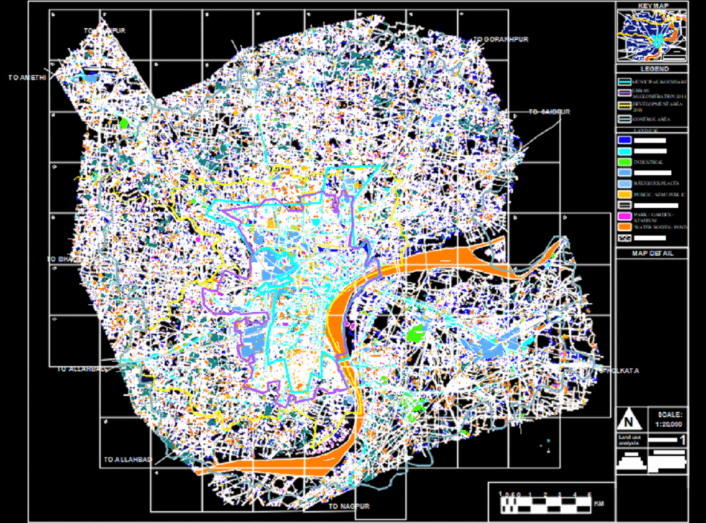
Download Delhi Urban Land Use Map DWG | Learn How to Create GIS-CAD Based Maps
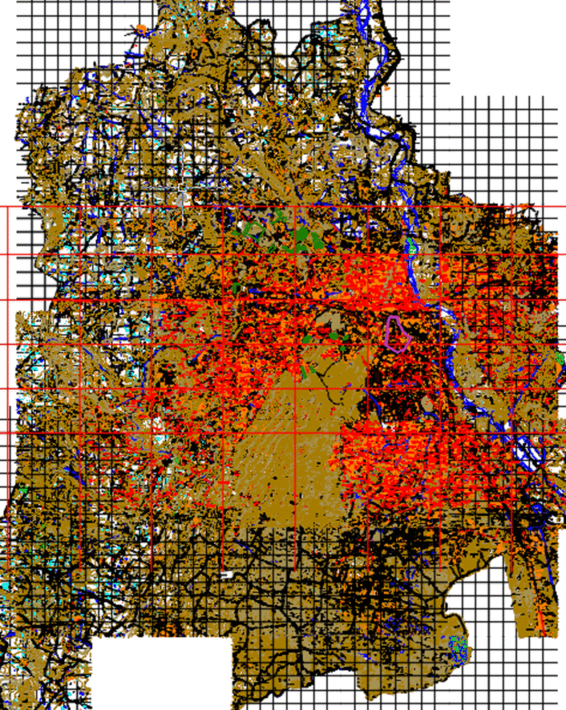
Explore a CAD-based land use map of Delhi with grid overlays. Learn how to analyze satellite data, convert GIS to AutoCAD, and create a city-scale map for planning or thesis work. 🌆 1. What This Drawing Shows This map is a macro-level planning tool for Delhi, showing: 🔴 Urban density zones (likely in red) […]
Free Download: Public Building Grid-Based Floor Plan DWG + AutoCAD Tutorial
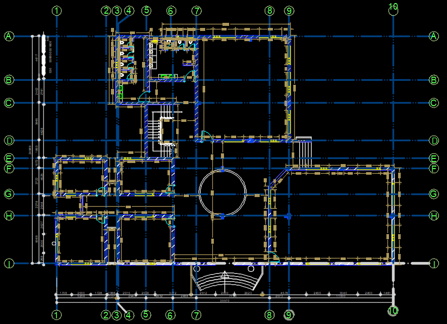
Download a well-planned public building DWG with full grid layout. Learn how to interpret column-grid planning and draft similar structures in AutoCAD from scratch. 📐 1. What This Drawing Shows? This CAD drawing shows a grid-referenced layout of a public building. You can see: 🔲 Gridlines (A–I & 1–10) for structural column planning 🔄 Central […]
Master Plan DWG: Free Download of Institutional/Resort Campus Layout + AutoCAD Tutorial
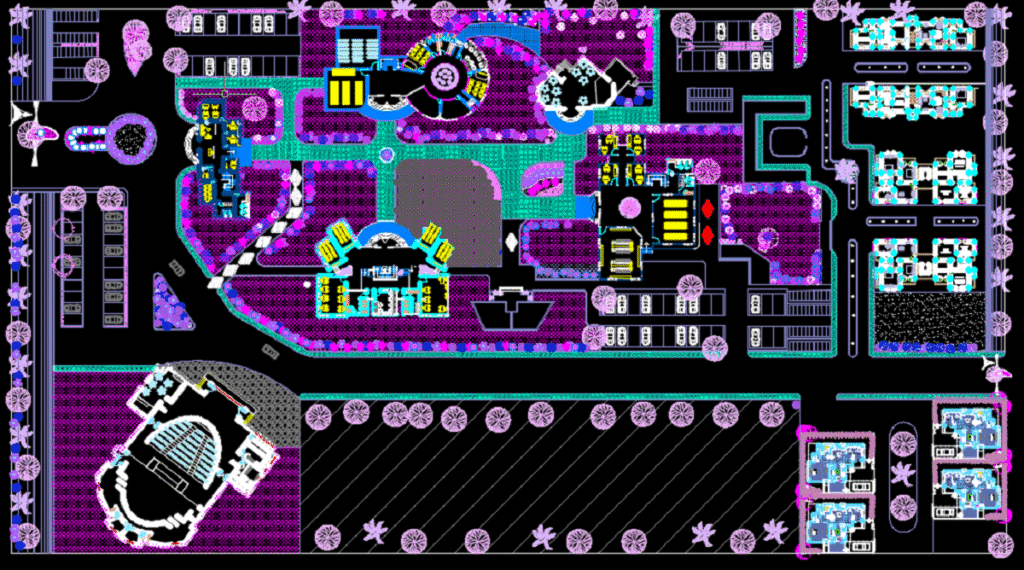
Explore a beautifully detailed campus layout for a resort or educational complex. Download the DWG and learn how to recreate it in AutoCAD, from blocks to zoning and landscaping. 📌 1. What This Drawing Represents This layout showcases a professionally planned institutional or hospitality campus, complete with: 🏢 Multiple Building Clusters (clearly zoned) 🅿️ Vehicular […]
Land Use Plan DWG Example – How to Read & Redraw It in AutoCAD
Download a free DWG of a land use zoning map. Learn how to analyze, recreate, and master planning drawings using AutoCAD with this step-by-step guide for students and professionals. 📍 1. What This Drawing Shows? This drawing is a schematic land use plan typically used in: Urban planning projects Architecture or landscape architecture studios […]