Free Delhi Urban Fabric DWG Map – Explore & Recreate Lutyens’ Delhi in AutoCAD
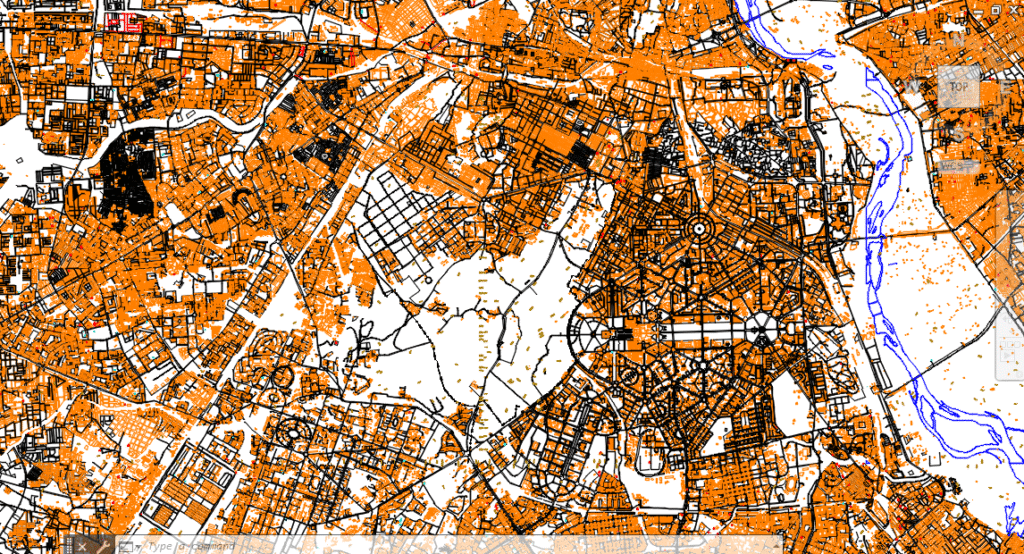
Explore Delhi’s most iconic radial-planned zones in this DWG map. Learn how to interpret and recreate built-up density maps using AutoCAD for urban design, planning, or thesis work. 🧭 1. What This Drawing Depicts This is a city-scale planning map focused on central Delhi, revealing: 🧱 Built-up zones (highlighted in orange) 🛣️ Lutyens’ road network […]
Land Use Plan DWG Example – How to Read & Redraw It in AutoCAD
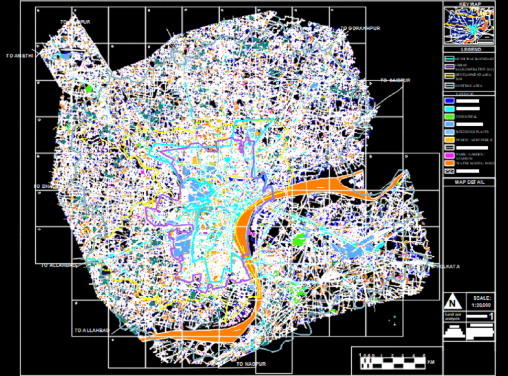
Download a free DWG of a land use zoning map. Learn how to analyze, recreate, and master planning drawings using AutoCAD with this step-by-step guide for students and professionals. 📍 1. What This Drawing Shows? This drawing is a schematic land use plan typically used in: Urban planning projects Architecture or landscape architecture studios […]